West Ironbound Island Lighthouse
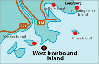
West Ironbound Locator Map
WEST IRONBOUND ISLAND I - Light Details
- Location: South side of island, entrance to LaHave River
- Standing: This light is no longer standing.
- Operating: This light is no longer operating.
- Began: 1855
- Year Lit: 1855
- Structure Type: Lantern on roof of square wood dwelling
- Light Characteristic: Flashing White (1922)
- Tower Height: 029ft feet high.
- Light Height: 070ft feet above water level.
History Items for This Lighthouse
- 1858 - 8 catatropic lamps, group flashing white (80s)
- 1922 - catatropic long focus lens, group flashing white (25s)
- 1987 - replaced by present tower
WEST IRONBOUND ISLAND II - Light Details
- Location: South side of island, entrance to LaHave River
- Standing: This light is still standing.
- Operating: This light is operational
- Automated: All operating lights in Nova Scotia are automated.
- Date Automated: Automated by 1966
- Began: 1987
- Year Lit: 1987
- Structure Type: Circular fibreglass tower, white, no lantern
- Light Characteristic: Flashing White (1992)
- Tower Height: 034ft feet high.
- Light Height: 080ft feet above water level.
History Items for This Lighthouse
- 1987 - replaced original tower of 1855
- 1992 - electric lantern, flashing white (12s)
Lightkeepers for West Ironbound Island Lighthouse
- Wolfe, John XXXX1858XX
Highlights
- County: Lunenburg
- Region: South Shore
- Body of Water: LaHave River
- Scenic Drive: Lighthouse Route
- Site Access: By Boat
- Characteristic: Flashing White (1992)
- Tower Height: 034 ft
- Height Above Water: 080 ft
- Latitude: 44~13~43.7
- Longitude: 64~16~28.0
- Off Shore: Yes
- Still Standing: Yes
- Still Operating: No