Pease Island Lighthouse
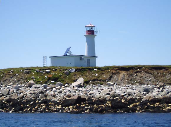
A good example of a fiberglass tower with a concrete equipment building.
Photo - © Kathy Brown, Pease Island Lighthouse, 2005
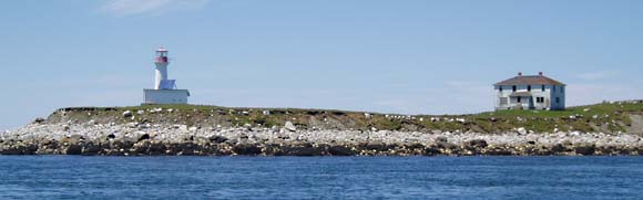
Pease Island Lighthouse and the abandoned keeper`s house, 2005
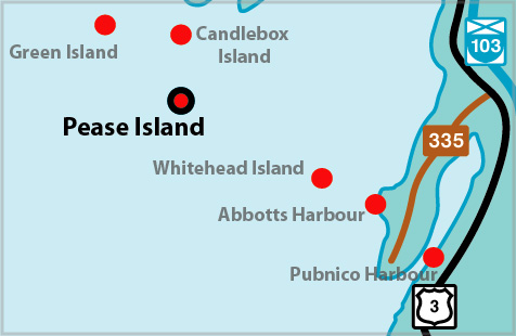
Pease Island Lighthouse Locator Map
PEASE ISLAND I - Light Details
- Location: South side of island, Tusket Islands
- Standing: This light is no longer standing.
- Operating: This light is no longer operating.
- Began: 1879
- Year Lit: 1879
- Structure Type: Square wood tower, white, dwelling attached
- Light Characteristic: Flashing White (1941)
- Tower Height: 042ft feet high.
- Light Height: 056ft feet above water level.
History Items for This Lighthouse
- 1883 - catatropic light, occulting red, 12m, two lights in operation - 1898 -fog
- 1922 - 1941 - catatropic long focus lens, group flashing white (20s)
- 1922 - catatropic, fixed red lower light, 4m, hand fog horn
- 1930 - two lights, white, red light 16ft lower, hand fog signal
PEASE ISLAND III - Light Details
- Location: South side of island, Tusket Islands
- Standing: This light is still standing.
- Operating: This light is operational
- Automated: All operating lights in Nova Scotia are automated.
- Date Automated: Automated by 1992
- Began: 1992
- Year Lit: 1992
- Structure Type: Circular fibreglass tower, white
- Solarized: This light has been solarized.
History Items for This Lighthouse
- 1992 - replaced second tower
Lightkeepers for Pease Island Lighthouse
Malone, Ranford 1981
Highlights
- County: Yarmouth
- Region: Yarmouth & Acadian Shore
- Body of Water: Schooner Passage
- Scenic Drive: Lighthouse Route
- Site Access: By Boat
- Characteristic:
- Tower Height:
- Height Above Water:
- Latitude: 43~37~42.6
- Longitude: 66~01~34.9
- Off Shore: Yes
- Still Standing: Yes
- Still Operating: No