McNabs Island Lighthouse Rear Range Light
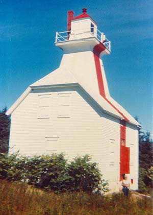
Photo - © Courtesy Joan McGregor, McNabs Island Lighthouse in Later Years
The lighthouse was automated in 1959. It was torn down in 1973.
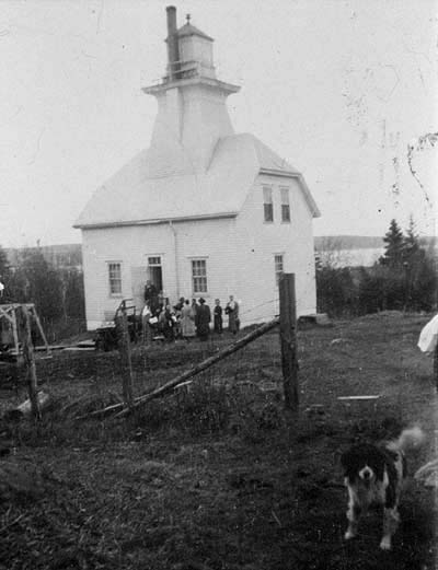
Lighthouse, 1940's
Photo - © Courtesy Joan McGregor
McNabs Island Lighthouse in the 1940`s. A Lost Lighthouse.
Colin Cleveland, Joan McGregor`s father, was the lightkeeper when this phtot was taken.
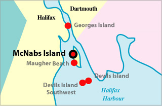
McNabs Island Lighthouse Locator Map
MCNABS ISLAND RANGES REAR - Light Details
- Light Type: Rear Range Light
- Location: On top of Battery Point hill, west side of island
- Standing: This light is no longer standing.
- Operating: This light is no longer operating.
- Date Automated: Automated by 1959
- Began: 1903
- Year Lit: 1903
- Structure Type: Square wood tower, white, on dwelling, red stripe
- Light Characteristic: Fixed Red (1941)
- Tower Height: 049ft feet high.
- Light Height: 132ft feet above water level.
History Items for This Lighthouse
- 1922 - catatropic lens, fixed white - 1937 - light changed to fixed red
- 1941 - catatropic lens - 1943 - light changed to fixed green
- 1959 - converted to electricity, automated - 1969 - light changed to fixed red
- 1973 - replaced by skeleton tower - 1976 - structure torn down
Lightkeepers for McNabs Island Lighthouse Rear Range Light
- Doody, J. 1903-1905
- Lynch, M. 1905-1932
- Cleveland, Colin W. 1932-1957
- Lumsden, B.J. 1957
- Eddy, W. 1957-1959
Highlights
- County: HRM
- Region: Halifax Metro
- Body of Water: Halifax Harbour
- Scenic Drive: Halifax / Dartmouth
- Site Access: By Boat
- Characteristic: Fixed Red (1941)
- Tower Height: 049 ft
- Height Above Water: 132 ft
- Latitude: 44~37~00
- Longitude: 63~32~12
- Off Shore: Yes
- Still Standing: No
- Still Operating: No