Marache Point Lighthouse
Owned by the Government of Canada
For local tourist information, go to Isle Madame Lighthouses .
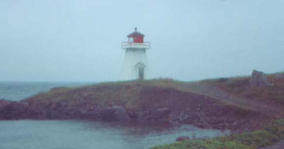
Photo - © Lew Perry, Marache Point Lighthouse
The lighthouse seen through light fog.
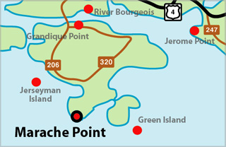
Marache Point Lighthouse Locator Map
MARACHE POINT - Light Details
- Location: South entrance to Arichat Harbour, Isle Madame
- Standing: This light is still standing.
- Operating: This light is operational
- Automated: All operating lights in Nova Scotia are automated.
- Date Automated: Automated by 1993
- Began: 1851
- Year Lit: 1851
- Structure Type: Tapered square wood tower, white, red lantern
- Light Characteristic: Fixed White (1992)
- Tower Height: 023ft feet high.
- Light Height: 034ft feet above water level.
History Items for This Lighthouse
- 1849 - local residents established a beacon
- 1883 - catatropic light, 8m, listed as Arichat Harbour
- 1922 - 5th order dioptric lens, fixed white, 8m, 25ft, 34ft, hand fog horn
- 1930 - fog signal - 1973 - automated by this date
Lightkeepers for Marache Point Lighthouse
Coste, Joseph XXXX1857XX
Highlights
- County: Richmond
- Region: Cape Breton Island
- Body of Water: Arichat Harbour
- Scenic Drive: Fleur-de-lis Trail
- Site Access: Requires Hike
- Characteristic: Fixed White (1992)
- Tower Height: 023 ft
- Height Above Water: 034 ft
- Latitude: 45~28~50.3
- Longitude: 61~02~04.6
- Off Shore: No
- Still Standing: Yes
- Still Operating: No