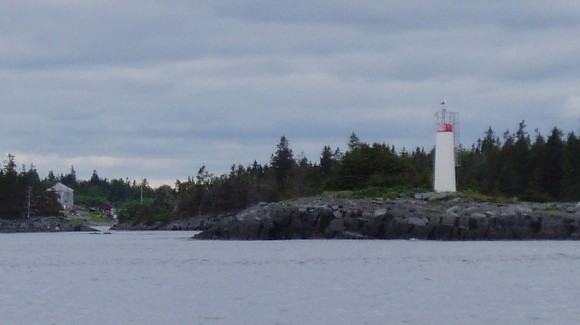
Gunning Point Island Lighthouse
This little fiberglass lighthouse is on a narrow channel used by fishermen.
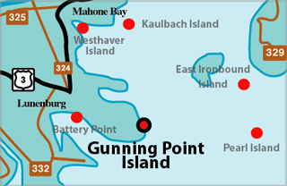
Gunning Point Island Lighthouse Locator Map
GUNNING POINT ISLAND I - Light Details
- Location: Eastern end of Tanner Island
- Standing: This light is no longer standing.
- Operating: This light is no longer operating.
- Date Automated: Automated by 1963
- Began: 1913
- Year Lit: 1913
- Structure Type: Square wood tower, white
- Light Characteristic: Fixed White (1941)
- Tower Height: 027ft feet high.
- Light Height: 033ft feet above water level.
History Items for This Lighthouse
- 1922 - 1941 - 5th order dioptric lens, seasonal (Apr - Jan)
- 1962 - 1965 - light raised from 29ft to 33ft
- 1973 - automated by this date
- 1990 - replaced by fibreglass tower
GUNNING POINT ISLAND II - Light Details
- Location: Eastern end of Tanner Island
- Standing: This light is no longer standing.
- Operating: This light is no longer operating.
- Began: 1986
- Year Lit: 1986
- Structure Type: Round fiberglass tower, no lanterm
Highlights
- County: Lunenburg
- Region: South Shore
- Body of Water: Mahone Bay
- Scenic Drive: Lighthouse Route
- Site Access: By Boat
- Characteristic:
- Tower Height:
- Height Above Water:
- Latitude: 44~22~01.5
- Longitude: 64~12~04.3
- Off Shore: Yes
- Still Standing: No
- Still Operating: No